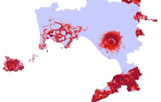
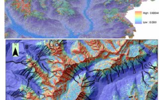
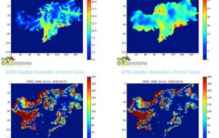
“Combining state of the art flood modelling, DEM-based approaches and machine learning intelligence to provide you the critical information you need into flood hazard and risk”
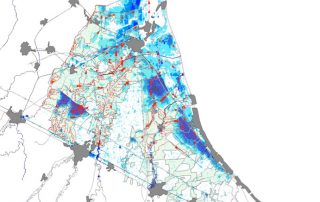
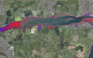
GECOsistema’s flood (fluvial, pluvial and coastal) maps are used by insurances, public agencies, private investors to visualise, assess and understand potential flood risk. Using state of art simulation software and accurate topographical data, we can generate flood maps and risk datasets for most countries around the world.
GECOsistema has a consolidate experience in natural hazard and risk mapping using well known hydrodynamic models and GIS Dem-based tools for hazard assessment with regard to:
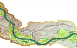
- Calibration and validation of simple DEM-based and advanced numerical models for hydrodynamic (river, pluvial and coastal) modeling of flooded areas and
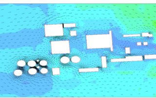
- Local scale modeling for optimization of infrastructures and hydraulic defense
- GIS based analysis of for wide area mapping of natural hazard in support of emergency and urban planning
Flood mapping problems can be solved, depending on scale of the problem, resolution and quality of using a GIS/DEM based – approach, grounded on knowledge and description of most relevant physical processes and on recorded evidences of real events.
GECOsistema provides flood models at local, regional and national flood risk worldwide exploiting the access to high-quality and resolution topographic and flood data from around the globe, including pluvial (surface), fluvial (river) and tidal sources.
This allows us to generate both local and national flood models for almost anywhere in the world.
SMARTFLOOD and URBAN_SMARTFLOOD, developed by GECOsistema, consists in Cloud-Web platform for quickly map fluvial flood hazard and risk over large flood-prone areas and pluvial hazard in the main cities in Europe and worldwide.
Detailed analysis, that involve use of hydraulic mechanistic models for 1D to 3D modeling , are suitable from coarse to local scale problems once accurate data availability is granted (topography and hydrology above all).
Well known state of the art codes handled by GECOsistema include: LISFLOOD, HEC- RAS, River 2D, BREZO modeling, ANUGA or TELEMAC-2D.
GECOsistema’s experience in Hazard modeling is documented by a long list of projects undertaken worldwide in riverine , urban and coastal environment.
The purpose of the assessment is to ensure that decision makers consider the environmental impacts when deciding whether or not to proceed with a project. The International Association for Impact Assessment (IAIA) defines an environmental impact assessment as “the process of identifying, predicting, evaluating and mitigating the biophysical, social, and other relevant effects of development proposals prior to major decisions being taken and commitments made.”[1]
EIAs are unique in that they do not require adherence to a predetermined environmental outcome, but rather they require decision makers to account for environmental values in their decisions and to justify those decisions in light of detailed environmental studies and public comments on the potential environmental impacts.
Strategic environmental assessment (SEA) is a systematic decision support process, aiming to ensure that environmental and possibly other sustainability aspects are considered effectively in policy, plan and programme making. In this context, following Fischer (2007)[1] SEA may be seen as:
- a structured, rigorous, participative, open and transparent environmental impact assessment (EIA) based process, applied particularly to plans and programmes, prepared by public planning authorities and at times private bodies,
- a participative, open and transparent,possibly non-EIA-based process, applied in a more flexible manner to policies, prepared by public planning authorities and at times private bodies, or
- a flexible non-EIA based process,applied to legislative proposals and other policies, plans and programmes in political/cabinet decision-making.
Effective SEA works within a structured and tiered decision framework,aiming to support more effective and efficient decision-making for sustainable development and improved governance by providing for a substantive focus regarding questions, issues and alternatives to be considered in policy, plan and programme(PPP) making.
SEA is an evidence-based instrument, aiming to add scientific rigour to PPP making, by using suitable assessment methods and techniques.
From 2005-2007, the effect of the directive was assessed. In 2010, a revised wording was published, integrated with 6 other European directives regulating large industrial sites, into the Industrial Emissions Directive, short IED.

